Crazy about the Greek island of Crete!
Map of Crete Guide
Table of Contents
This Map of Crete Guide will reveal many beach resorts, Crete tourist attractions, and ways to get around Crete. For visitors looking for the best maps of Crete for tourists, this guide covers everything needed to explore this beautiful island. Crete is the largest of the Greek islands and is the most southerly.
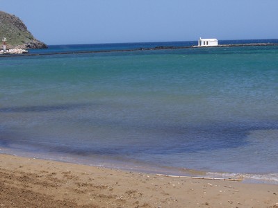
A Crete map shows that it lies outstretched at the southern edge of Europe, embraced by the bluest of blue Mediterranean, Aegean, Ionian, and Libyan Seas gently caressing the golden sands of its numerous pristine beaches.
Map of Crete Guide: Explore Top Destinations
Crete is filled with fascinating places that tell stories of ancient civilizations, seaside charm, and local life. Here’s a look at some of the top towns in Crete to visit and what makes each region special. Use this Map of Crete Guide to explore the best spots and unique experiences each main region has to offer.
Chania – A Blend of History and Beauty
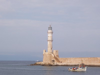
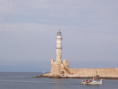
Chania, on Crete’s western side, is known for its Venetian Harbor, with colorful buildings and cobbled streets that feel like stepping back in time. Here you’ll find:
- Old Town: Wander the narrow alleys filled with cafes, boutique shops, and remnants of Venetian architecture.
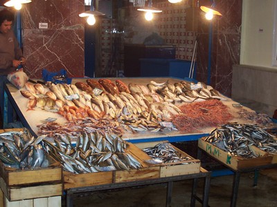
- Agora Market: Experience local life and grab some delicious produce, olive oil, or Cretan herbs.
- Balos Beach: A bit of a trek but well worth it, Balos is famous for its turquoise waters and white sand.
“Chania’s Old Town is a place where the past and present dance together in the most charming way.”
Rethymnon – A Charming Mix of Cultures
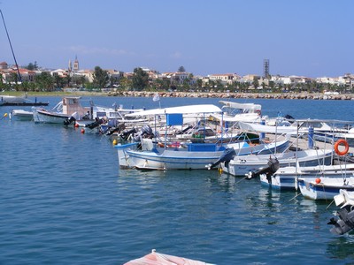
Rethymnon’s old quarter is a joy to explore, with influences from the Venetian and Ottoman periods creating a unique atmosphere. The town has a relaxed vibe with some gems you won’t want to miss:
- Fortezza Castle: Overlooking the sea, this 16th-century fortress offers incredible views and a glimpse into Crete’s past defenses.
- Rimondi Fountain: This beautiful Venetian fountain is a popular stop in the heart of the Old Town.
- Beaches: Rethymnon boasts long sandy beaches, perfect for a day of relaxation.
“If you love a blend of architecture, history, and beach time, Rethymnon is your town.”
Heraklion – Crete’s Bustling Capital
Heraklion is the island’s capital and largest city, offering a lively mix of history and modern amenities. It’s the cultural heart of Crete with a bit of everything:
- Palace of Knossos: Just outside Heraklion, this ancient Minoan palace is Crete’s most famous archaeological site.
- Heraklion Archaeological Museum: Home to an impressive collection of artifacts from the Minoan civilization.
- Koules Fortress: Sitting at the harbor entrance, this Venetian fortress is an iconic Heraklion landmark.
“In Heraklion, history lovers will feel right at home.”
Agios Nikolaos – Seaside Sophistication
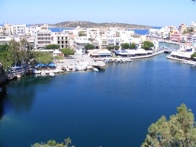
Agios Nikolaos on the eastern coast has a cosmopolitan flair, known for its scenic lake and laid-back charm. Some highlights include:
- Lake Voulismeni: This lovely lake is surrounded by cafes and restaurants, creating a picturesque spot to unwind.
- Elounda: Just a short drive away, Elounda is a luxury resort area with high-end hotels and beautiful beaches.
- Spinalonga Island: Once a leper colony, this small island is a hauntingly beautiful place steeped in history.
"
Agios Nikolaos combines sophistication with seaside charm,
making it a perfect destination for those who want to relax with style.”
Ierapetra – Crete’s Southern Gem
Ierapetra, on Crete’s southern coast, offers a completely different vibe from the north. Known for its warm weather and secluded beaches, it’s a peaceful escape:
- Old Town: Wander through the historic streets and see the Ottoman mosque and Venetian fortress.
- Chrissi Island: A short boat ride from Ierapetra, this uninhabited island boasts pristine beaches and crystal-clear waters.
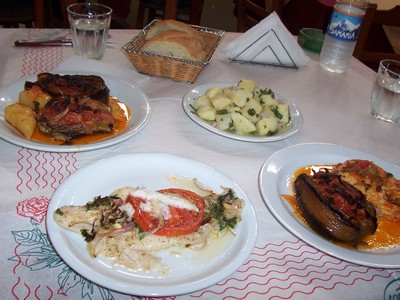
- Local Tavernas: Experience authentic Cretan food at one of the many small, family-run tavernas.
“Ierapetra’s laid-back atmosphere and hidden beaches make it a true escape.”
These top towns in Crete offer a little bit of everything—from history and vibrant culture to serene beaches and stunning landscapes. With this Map of Crete Guide, you’ll be ready to explore each region’s unique experiences, whether you're captivated by ancient ruins or drawn to Cretan seaside charm.
Map of Crete Guide to
Crete Tourist Attractions
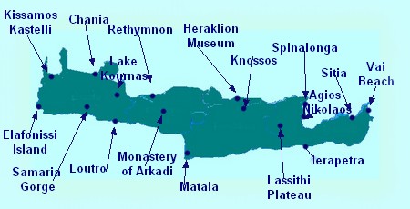
Most Crete maps will highlight the main tourist attractions, including a top Crete attractions map to help visitors find their way to sites like the famous Samaria Gorge, Lake Kournas, the Palace of Knossos, the Heraklion Archaeological Museum, Lassithi Plateau, and Vai Beach. These sites all feature on maps of Crete.
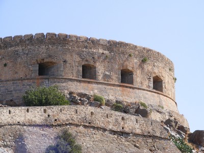
For those interested in history, a historic sites map of Crete will point to essential destinations such as Spinalonga Island—a place with a dramatic and varied history, finishing as Europe’s last leper colony. Spinalonga is also the setting for the bestselling novel The Island by Victoria Hislop. The Monastery of Arkadi, significant for both religious and historical reasons, is another popular attraction on Crete maps.
The picturesque main towns of Crete, such as Kissamos Kastelli, Chania, Rethymnon, Heraklion, Agios Nikolaos, Sitia, and Ierapetra, are all marked on Crete maps and are well worth visiting to experience a true flavor of Crete.
Map of Crete Guide to
Beaches
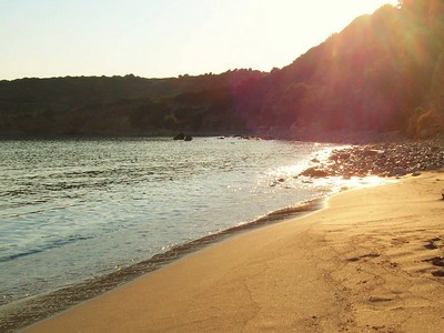
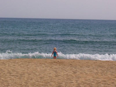
From the tiny Island of Elafonissi in the west of Crete to Vai Beach at the far east, you'll find much to explore on Crete maps. A local guide to Crete’s beaches will reveal beautiful beach resorts and charming fishing villages, especially on the south coast, where popular spots like Loutro and Matala attract many visitors each year. On the north coast, popular Crete beach resorts such as Malia, Stalis, Hersonissos, Platanes in Rethymnon, and Platanias in Chania are highly sought after.
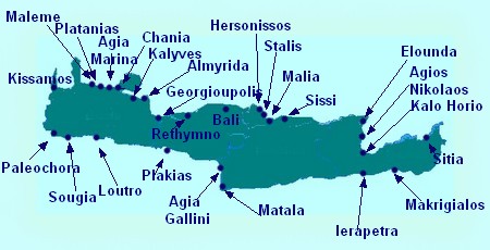
The island’s most popular holiday destinations and beach resorts are well-outlined on a map of Crete. From the far west tip at Kissamos to the eastern gem of Sitia, and the serene south coast villages of Ierapetra, Makrigialos, Agia Galini, Matala, Plakias, Loutro, Sougia, and Paleochora, there’s a beach to suit every traveler’s taste.
Discover the stunning shores of Crete and uncover hidden gems along the coastline! Find out more about the Best Beaches in Crete and start planning your perfect beach getaway.
On the north coast near Chania, the popular resorts of Maleme, Platanias, and Agia Marina, along with the picturesque Apokoronas fishing villages of Kalyves and Almyrida, are all clearly marked on Crete maps.
In central Crete, you'll find the ever-popular Georgioupolis, Rethymnon, Bali, and Sissi. Further east lie the bustling beach resorts of Hersonissos, Stalis, and Malia, with Elounda, Agios Nikolaos, and the quaint Istron Kalo Horio marking the eastern end of Crete’s beach destinations.
Map of Crete Guide to
Resorts
Crete is blessed with a fantastic variety of beach resorts, each offering something a little different. Whether you’re looking for family-friendly destinations, lively nightlife, or a quiet retreat by the sea, Crete has a resort to match. Our Map of Crete Guide will help you pinpoint the top spots to suit your travel style. Here’s a closer look at some popular resort areas across the island.
Here's our best of the best.
Malia – For Party Lovers and Beach Fans
If you’re seeking nightlife, Malia is the place to be. Known for its energetic atmosphere, Malia is a magnet for those wanting a lively beach holiday.
- Nightlife: Clubs and bars keep the town buzzing well into the early hours.
- Beautiful Beaches: The main beach is long, sandy, and ideal for relaxing in the sun.
- Activities: Water sports are plentiful, with jet-skiing, parasailing, and boat trips popular among visitors.
“Malia is perfect if you’re after a mix of sun-soaked beach days and lively nights out.”
Elounda – Luxurious Seaside Relaxation
Elounda is known for its upscale resorts and breathtaking views, drawing visitors who enjoy the finer things in life.
- High-End Resorts: You’ll find luxury hotels and spas here, ideal for a pampered stay.
- Serene Beaches: The beaches around Elounda are more tranquil, offering clear waters and a peaceful setting.
- Spinalonga Island: Just a short boat ride away, Spinalonga’s intriguing history adds a cultural touch to your relaxing getaway.
Elounda blends luxury with serenity, making it a perfect escape for those wanting a slower pace.
Hersonissos – A Family-Friendly Favorite
Hersonissos is known for its balance of family-friendly attractions and lively town atmosphere, offering plenty for visitors of all ages.
- Aquaworld Aquarium and Waterpark: Great fun for families, especially with young children.
- Beaches and Marina: The beaches are sandy and safe, and the marina is lined with cafes perfect for people-watching.
- Shopping and Dining: From traditional tavernas to modern shops, there’s something for everyone here.
For a family-friendly resort with plenty of activities, Hersonissos is a great choice.
With so many Crete resorts offering unique experiences, it’s easy to find the right fit for your holiday style. Our Map of Crete Guide can help you locate these resorts and plan your ideal Crete getaway. Whether you’re drawn to the luxury of Elounda, the history of Rethymnon, or the energy of Malia, Crete’s resorts are ready to welcome you to a memorable stay on this beautiful island.
Kalyves – Authentic Cretan Charm by the Sea
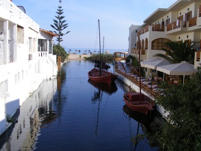
Kalyves is a peaceful seaside village located in the Apokoronas region, just a short drive from Chania. This charming resort is ideal for those seeking a relaxing getaway with a touch of authentic Cretan village life. Kalyves is perfect if you want to unwind and experience the local culture, without the bustling crowds of larger resorts.
- Sandy Beaches: Kalyves boasts two beautiful sandy beaches with shallow waters, making them ideal for families and those looking to swim and relax in the sun.
- Traditional Taverns: The village is dotted with family-run tavernas offering traditional Cretan dishes, often using locally sourced ingredients like fresh fish and organic produce.
- Local Markets: For a taste of everyday life, explore the local markets and shops where you can find olive oil, herbs, and honey produced by nearby farmers.
- Laid-Back Atmosphere: Kalyves has a slow, laid-back vibe, making it a wonderful place to escape the hustle and bustle and simply enjoy the natural beauty of Crete.
“Kalyves combines beautiful beaches with an authentic village feel – perfect for a quiet, refreshing holiday.”
Nearby Attractions: While Kalyves itself is a serene spot, it’s also conveniently located near interesting places for day trips. You’re close to the historical sites and vibrant markets of Chania, as well as the scenic Apokoronas villages like Vamos and Almyrida, each offering their own unique charm.
Whether you’re lounging on the sandy shores, savoring a delicious meal by the sea, or strolling through the village, Kalyves offers a taste of traditional Crete that’s hard to find elsewhere. Use this Map of Crete Guide to locate Kalyves and plan a stay that lets you experience both the beauty and simplicity of Cretan life.
Family-Friendly and Scenic Spots
Crete is a fantastic destination for families, offering a mix of kid-friendly activities, beautiful landscapes, and places that create lasting memories. From natural wonders to laid-back beaches, the island has plenty of attractions that are perfect for all ages. Use this Map of Crete Guide to plan visits to these top family-friendly and scenic spots.
1. Samaria Gorge – A Breathtaking Adventure
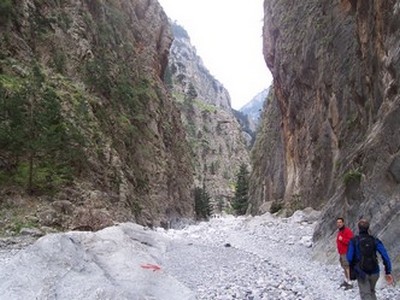
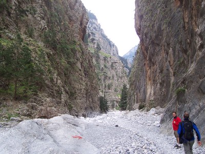
For families with older children or teens, hiking the Samaria Gorge can be an unforgettable experience. This scenic hike winds through one of Europe’s longest gorges, offering breathtaking views, rock formations, and even a chance to spot some native wildlife, like the rare Cretan kri-kri (wild goats).
- Length: 16 km (10 miles) – plan for about 4-6 hours of hiking.
- Difficulty: Moderate, so it’s best for children who can handle longer walks.
- Highlight: The “Iron Gates,” a narrow pass between towering cliffs, is a thrilling spot for photos.
"Samaria Gorge isn’t just a hike—it’s an adventure through one of Crete’s natural wonders."
2. Lake Kournas – A Peaceful Day by the Water
Lake Kournas, Crete’s only freshwater lake, is a perfect spot for a relaxing family outing. Surrounded by hills, this scenic lake offers paddleboats for rent, so kids can enjoy a gentle ride on the calm waters.
- Activities: Paddle boating, swimming, and picnicking by the lake.
- Kid-Friendly: Shallow waters near the shore make it safe for younger kids to play.
- Nearby Taverns: There are family-friendly taverns around the lake, where you can enjoy a meal with beautiful lake views.
"Lake Kournas is a hidden gem for families—a place to unwind and enjoy Crete’s natural beauty."
3. Elafonissi Beach – Pink Sand and Crystal Waters
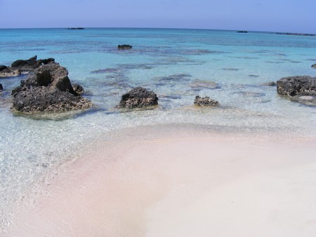
Elafonissi Beach is known for its unique pink sand and shallow, turquoise waters, making it a favorite for families. Kids love splashing around in the clear, warm shallows, and parents enjoy the stunning scenery.
- Safe for Kids: The shallow waters are perfect for young children to play.
- Facilities: Sunbeds, umbrellas, and food stalls are available, making it easy to spend a full day.
- Scenic Beauty: The pinkish sand and clear water create a magical atmosphere you won’t want to miss.
“Elafonissi Beach is like a natural playground with colors straight out of a fairy tale.”
4. Rethymnon Old Town – History and Charm
A stroll through Rethymnon’s Old Town offers a relaxed and educational experience for families. With its cobblestone streets, Venetian architecture, and small shops, it’s a great place to explore and take in Crete’s rich history.
- Fun for All Ages: Kids enjoy the old-world atmosphere, and there are plenty of cafes and ice cream spots for treats.
- Sites to See: Fortezza Castle, Rimondi Fountain, and charming alleyways make this town a delight to wander.
- Shopping: Little souvenir shops and artisan crafts make it a fun place for kids to pick a keepsake.
5. Aquaworld Aquarium and Reptile Rescue Centre – Hands-On Fun
Located in Hersonissos, Aquaworld is a small, family-run aquarium and reptile rescue center that’s perfect for younger children who love animals.
- Hands-On Experience: Kids can touch and hold certain reptiles under supervision.
- Educational: Learn about marine life and reptiles native to Crete and Greece.
- Perfect for Rainy Days: Aquaworld is a great indoor activity if you encounter a cloudy day.
“Aquaworld is a hit with kids who love animals and are eager to learn about Crete’s native creatures.”
6. Botanical Park and Gardens of Crete – Nature and Wildlife
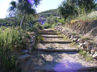
Located near Chania, the Botanical Park and Gardens of Crete is a lovely spot for families interested in nature. The park is home to a wide variety of plants, trees, and even some animals, creating a peaceful and educational setting.
- Easy Walks: The paths are well-maintained, making it easy for children to explore.
- Seasonal Plants: Discover Cretan flora along with exotic plants from around the world.
- Interactive Learning: Kids can learn about Mediterranean plants, herbs, and how they’re used in traditional Cretan life.
"A stroll through the Botanical Park offers a glimpse into Crete’s natural diversity."
Each of these family-friendly and scenic spots adds something special to a Crete vacation, combining beauty, relaxation, and a touch of adventure. Using our Map of Crete Guide, you can easily find these locations and plan a trip that both kids and adults will love. Crete has something for every family member, from sandy beaches to cultural gems and outdoor adventures.
Getting Around Crete
From the tiny Island of Elafonissi in the west of Crete to Vai Beach at the far east, you'll find much to explore on Crete maps. A local guide to Crete’s beaches will reveal beautiful beach resorts and charming fishing villages, especially on the south coast, where popular spots like Loutro and Matala attract many visitors each year. On the north coast, popular Crete beach resorts such as Malia, Stalis, Hersonissos, Platanes in Rethymnon, and Platanias in Chania are highly sought after.
Many car hire rental firms now offer sat. nav. systems to help visitors easily navigate the island. While these can be helpful, a physical map still has its uses—especially when exploring remote areas where GPS signals may be unreliable. The island’s most popular holiday destinations and beach resorts are well-outlined on a map of Crete. From the far west tip at Kissamos to the eastern gem of Sitia, and the serene south coast villages of Ierapetra, Makrigialos, Agia Galini, Matala, Plakias, Loutro, Sougia, and Paleochora, there’s a beach to suit every traveler’s taste.
On the north coast near Chania, the popular resorts of Maleme, Platanias, and Agia Marina, along with the picturesque Apokoronas fishing villages of Kalyves and Almyrida, are all clearly marked on Crete maps.
In central Crete, you'll find the ever-popular Georgioupolis, Rethymnon, Bali, and Sissi. Further east lie the bustling beach resorts of Hersonissos, Stalis, and Malia, with Elounda, Agios Nikolaos, and the quaint Istron Kalo Horio marking the eastern end of Crete’s beach destinations.
Car Hire Companies in Crete
Here are some reputable car hire companies in Crete that are popular with tourists and offer reliable services.
- Website: https://www.autounion.gr
- Auto Union is well-known in Greece and offers a wide selection of vehicles, including compact cars and SUVs suitable for Crete’s roads. They have multiple locations across Crete, including major airports and towns.
- Website: https://www.rental-center-crete.com
- This is a local company with excellent reviews for customer service and transparent pricing. They offer unlimited mileage, full insurance with no excess, and free extra drivers, which can be valuable for visitors exploring Crete extensively.
- Website: https://www.kafetzakis.gr
- This family-owned local company offers personalized service and is known for its customer-focused approach. They provide 24/7 roadside assistance and a variety of vehicles suited for Crete's terrain.
Want to discover even more of what Crete has to offer?
Explore hidden gems, must-visit spots, and insider tips below!
Just Some of the Reasons We Love Crete
Did you love this page? Please share it with your friends!
© Copyright All Original Content 2006 - 2025 Completely-Crete.com. All
Rights Reserved. Reproduction in whole or in part without permission is
not permitted.
Click here to learn about developing your own money-generating website
from Solo Build It! - even with little or no web experience!
